It is a method that qualitatively indicates the permeability characteristic of the formations.

Mobile Unity
Our mobile unit is set up at the well site and the interpretation of collected data generates logs on the petrophysical or geometric characteristics of geological formations, providing the following information:
Types of Geophysical Logs
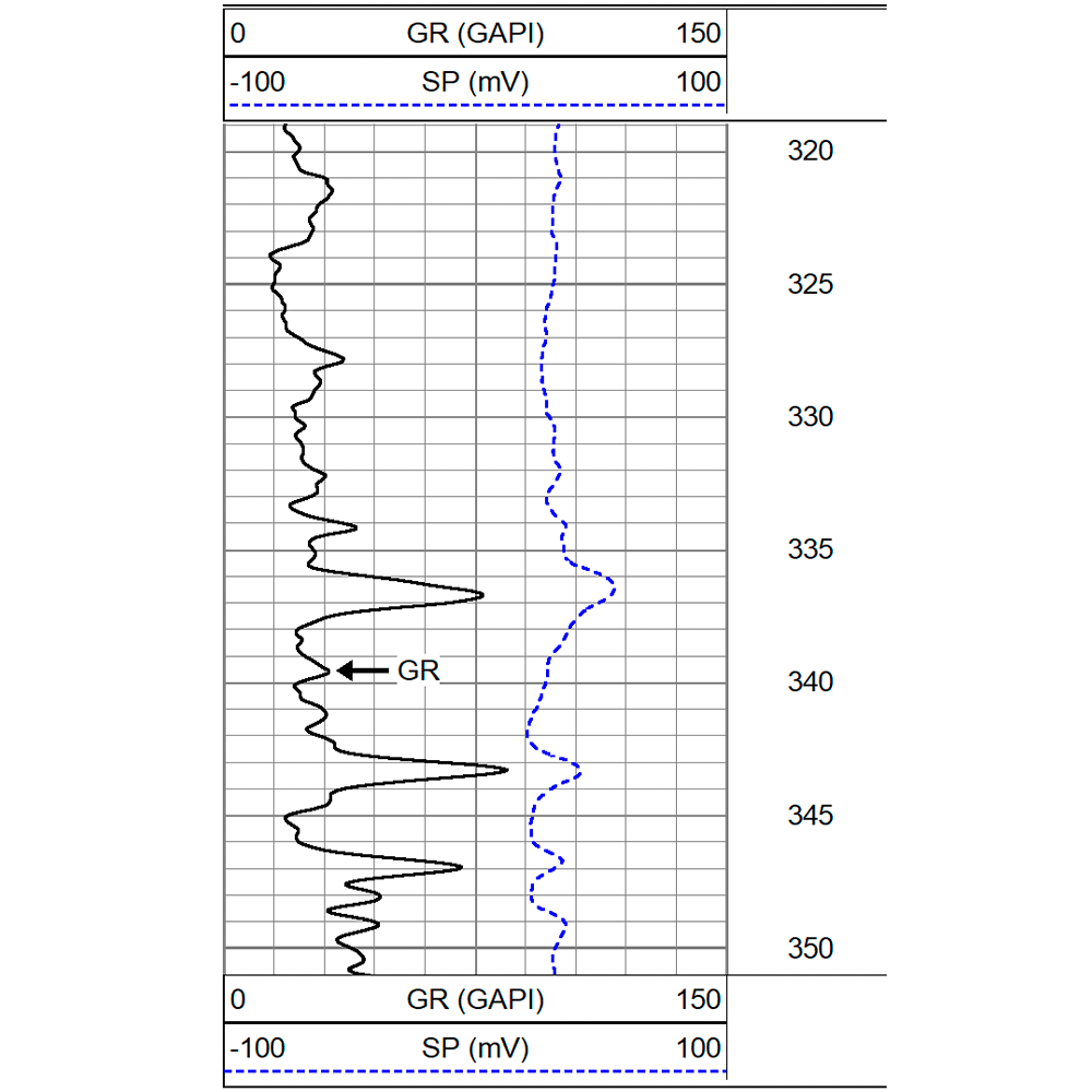
The method allows for the percentage calculation of clay content, as well as measurement of natural radioactivity of rocks and sediments, granulometric variation of layers, and correlation between wells.
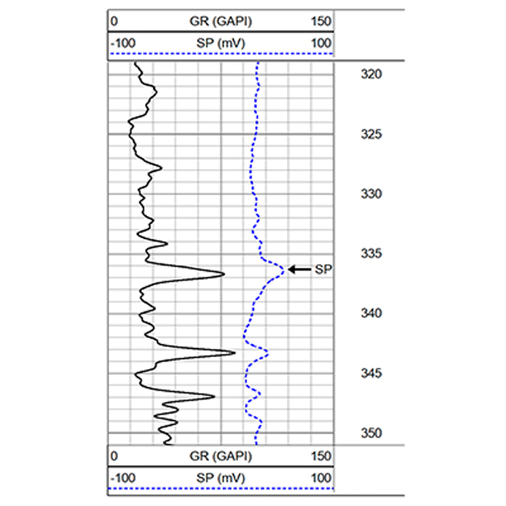
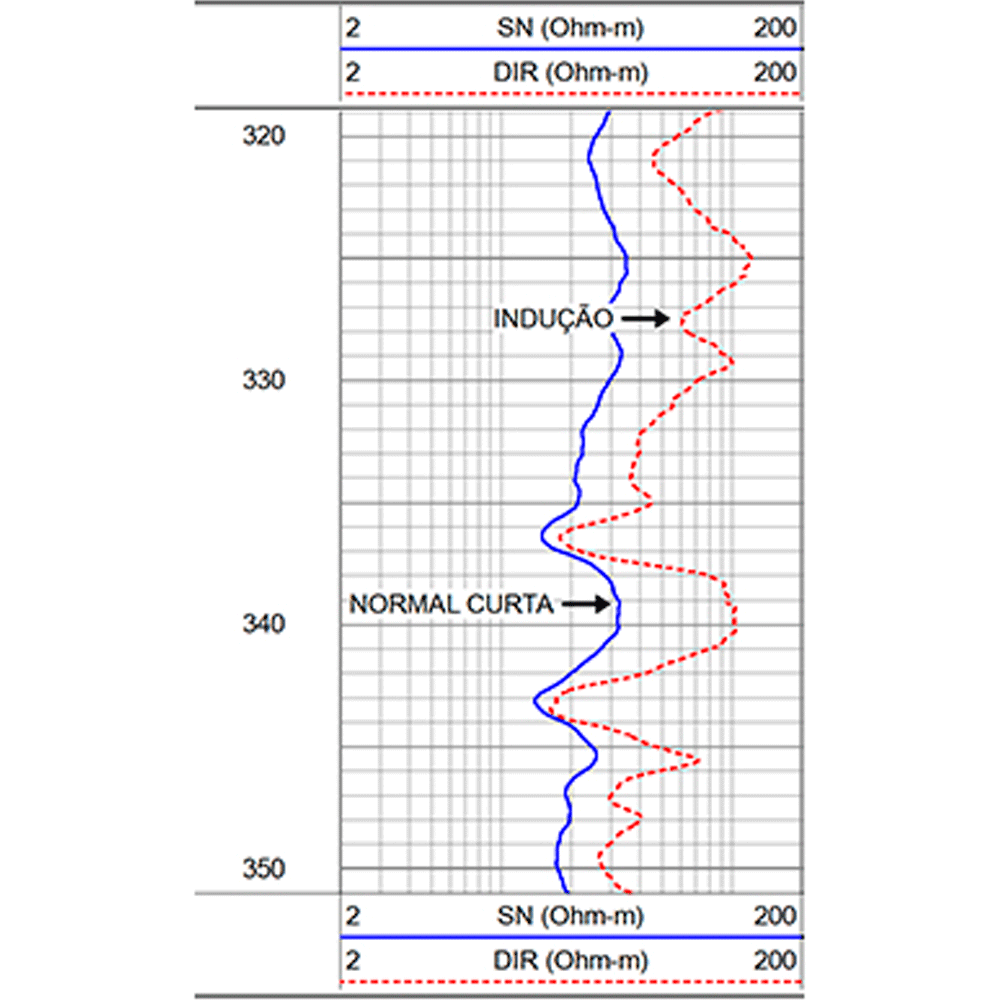
The IEL probe obtains the resistivity of formations, in order to calculate the salinity of the aquifer, as well as identifying the different lithologies crossed by the drilling of the well under study.”
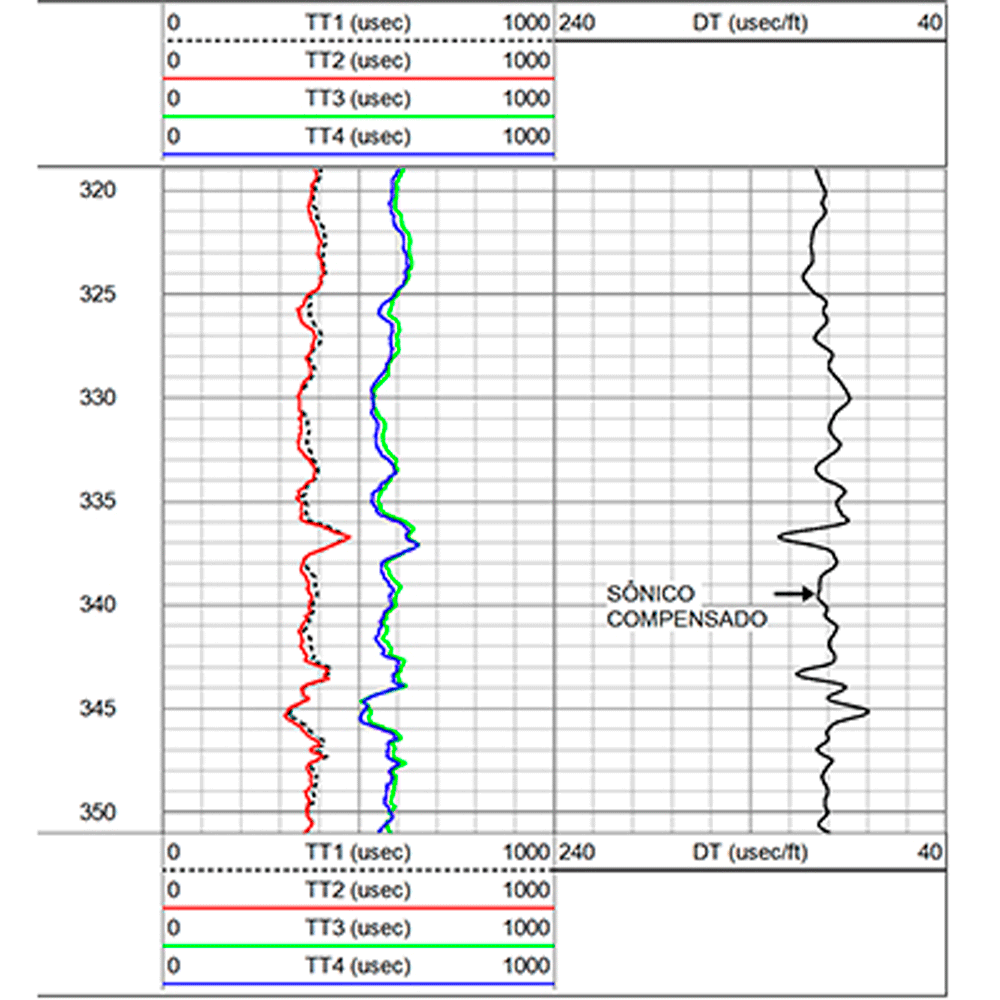
The Sonic tool reads the total porosity of the rocks. With this report, it is possible to calculate the effective porosity of the reservoir rock under study and then qualitatively evaluate the water storage capacity of this rock.
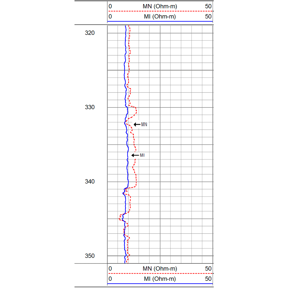
Through micro resistivity reports, this log identifies very thin bedrock layers, (up to one inch thick), and indicates, qualitatively, the absolute permeability of the rocks. The Caliper used in the MEL allows for the detection of mud cake and assists in the identification of permeable zones of the well, in the quality and stability of the well diameter.
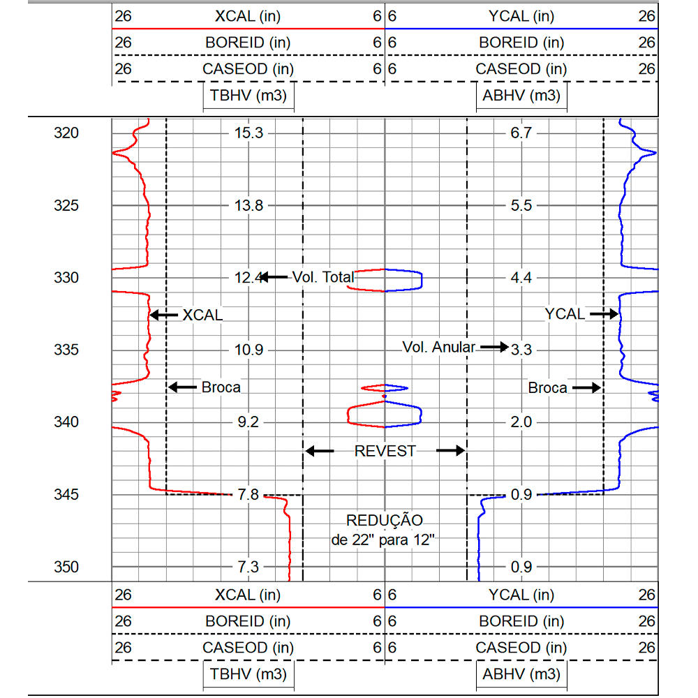
The method allows for tracing the log of the vertical section of the well, showing variations in diameter (restrictions, caving, ovalizations). It also provides the calculation of the integrated volume of the wells to evaluate the amount of cement or gravel pack required for the final well’s completion.
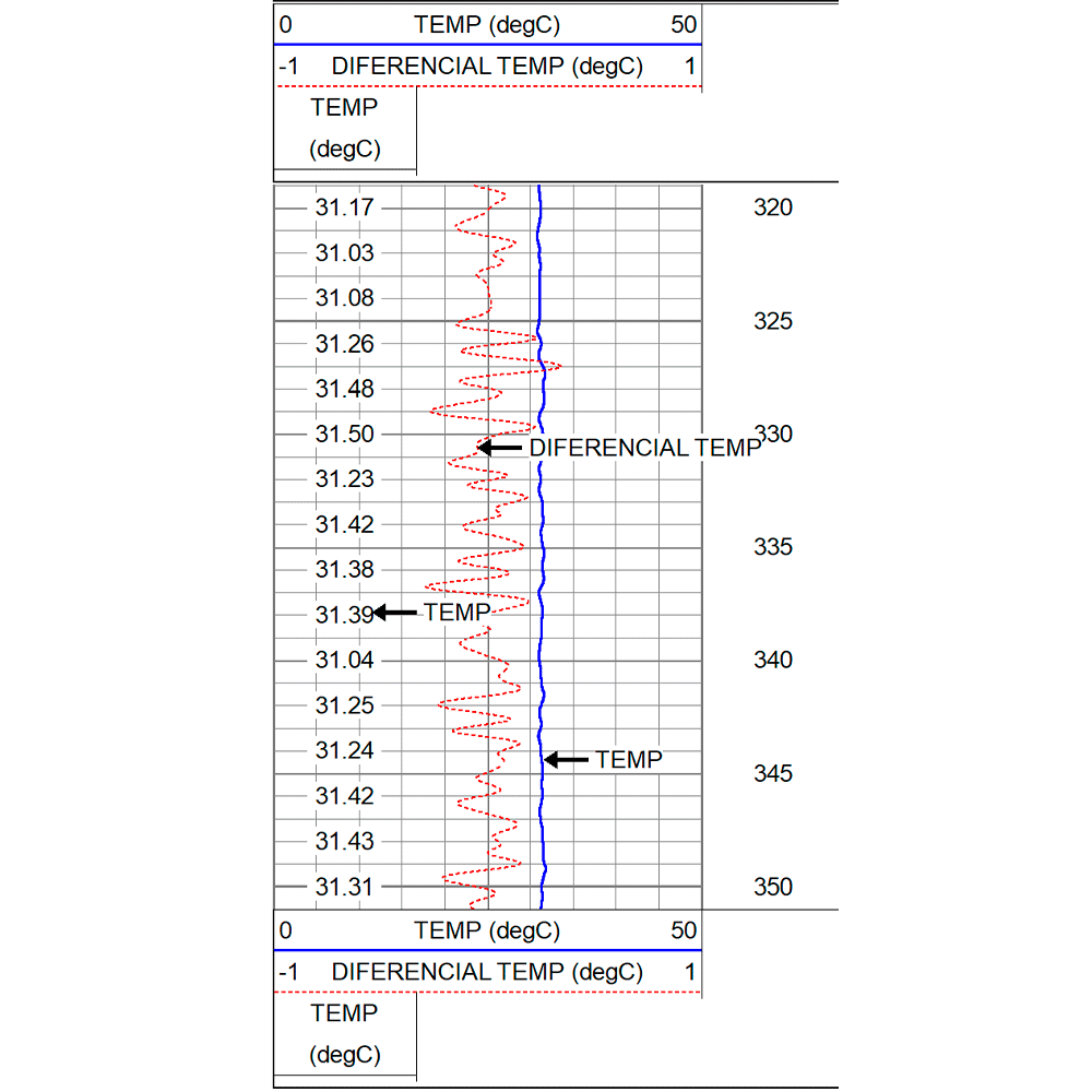
This probe measures the continuous well temperature variations throughout its entire length (Geothermal Gradient).
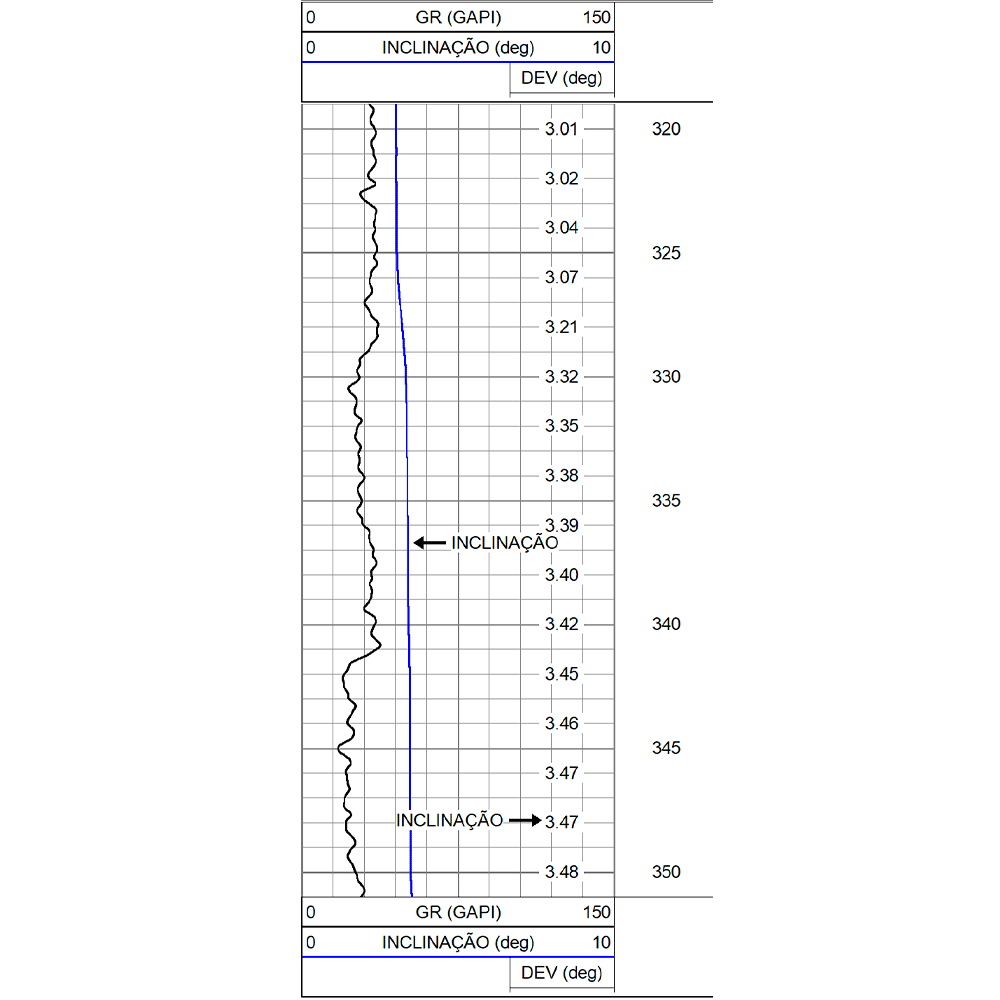
This probe measures the tilt or continuous deviation of the well from the vertical.