Mining
The high-performance tools and advanced geophysical logging methods provided by Hydrolog, allow to acquire, on the surface, information of the description of geology in deep wells.
It is possible to confirm the presence of some mineral deposits or even determine the geometry of the ore body after data processing.
Water Table Lowering
The application of the geophysical logging can assist mining activity to lower the water table level. The analysis allows for identifying the best intervals for the water production along with the minimum amount of fine waste production.
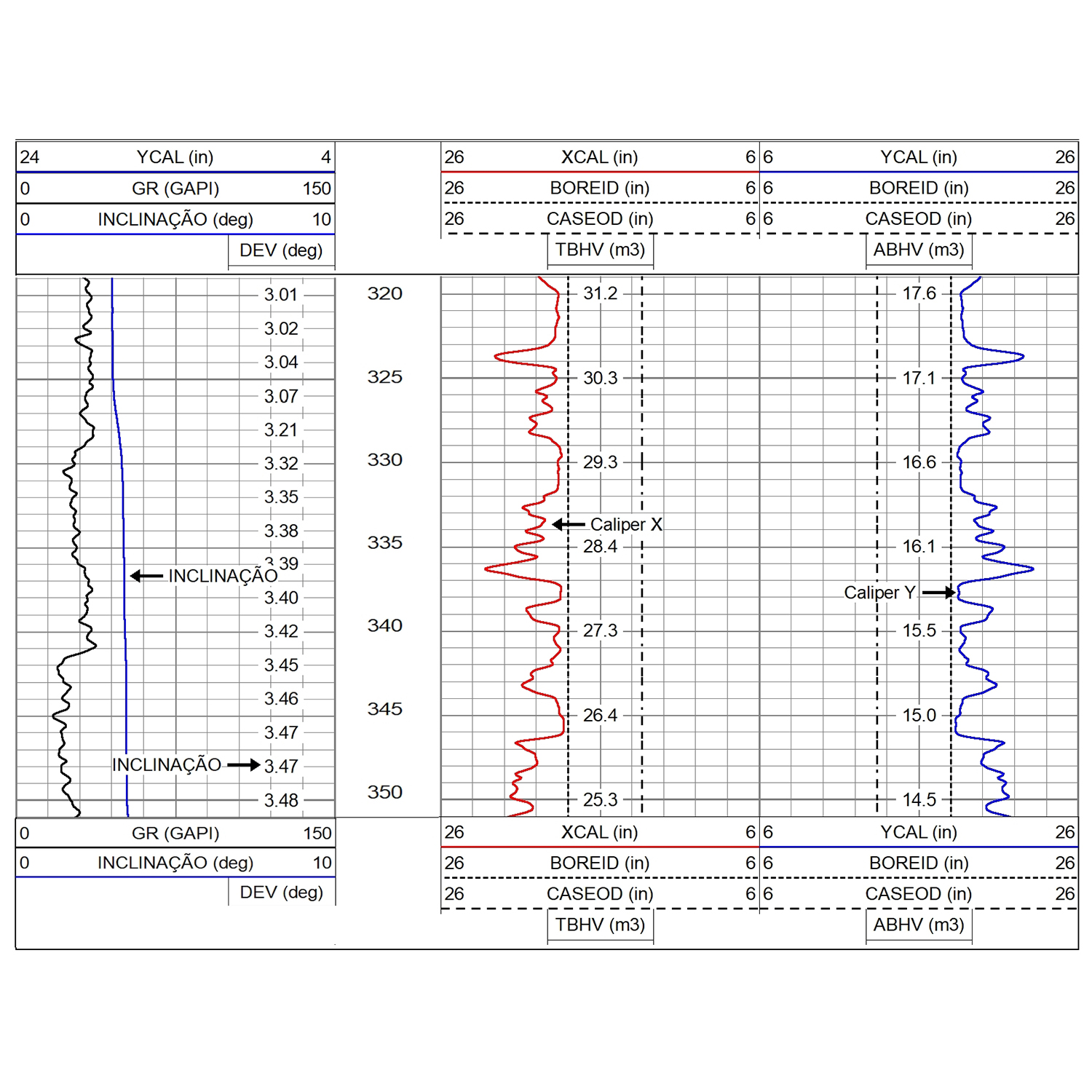
Caliper and Tilt
In mining, the Caliper XY and Inclination log assists in the construction safety of wells, identifying possible undermining, breakage, and falls. In this aspect, we guarantee, before completion, the necessary certainty for cost reduction and optimization in well construction.
Caliper can also assist in demarcating horizon markers, revealing breakages or discontinuities that delimit layers of interest or bodies of ore.
Finally, it can assist in the geotechnics of the mine, revealing the position of the main fractures.